The Atlas of Ancient and Classical Geography
The Atlas of Ancient and Classical Geography
This atlas resurrects the ancient world in meticulous detail, offering maps that let readers walk the streets of Athens, trace the campaigns of Alexander, and follow trade routes across the Mediterranean. Each map is accompanied by an index linking classical place names to their geographical realities, making it an essential companion for anyone reading Herodotus, Thucydides, or Gibbon. The coverage spans Greece, Italy, Asia Minor, and North Africa, showing how mountains channeled armies and coastlines determined which cities thrived. Ernest Rhys's editing ensures the presentation remains clear and functional, a window into the physical world that shaped every major event of classical antiquity. Whether you are a student wrestling with ancient texts or a reader seeking to visualize the Odyssey's journey, this atlas provides the geographical grounding that transforms historical reading into vivid experience.
Editions
X-Ray
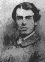
The original author of the Classical Atlas, former head-master of Shrewsbury school and later Bishop of Lichfield and Coventry. He was an editor of Aeschylus and noted geographer who created this foundational work of ancient geographical reference.
Prominent historian whose 'History of Greece' is frequently referenced throughout the work. His geographical methodology and spelling conventions for Greek place-names serve as a primary example for atlas usage.
Author of 'Decline and Fall of the Roman Empire' whose geographical descriptions and Latin place-name conventions are extensively analyzed. His work represents the Roman geographical tradition in contrast to Greek sources.
Ancient Greek historian referred to as 'the father of the recorders of history and geography.' His geographical accounts provide foundational material for understanding ancient world mapping.
About The Atlas of Ancient and Classical Geography
Chapter Summaries
- Introduction
- Butler explains the purpose and methodology of the Classical Atlas, emphasizing its role in supporting readers of classical histories like Grote's Greece and Gibbon's Roman Empire. He provides detailed comparisons of spelling conventions between different historians and demonstrates how the atlas can be adapted to various classical works.
- Maps List
- A comprehensive catalog of all maps included in the atlas, covering the entire ancient world from Britain to Egypt, including specialized maps for Palestine, barbarian migrations, and the geographical knowledge of Herodotus and Ptolemy. The list demonstrates the atlas's comprehensive scope across different historical periods and regions.
- Index
- An extensive alphabetical index of geographical locations covered in the atlas, organized in sections from Abacænum to Zyrinæ. This index serves as a gazetteer for the ancient world, providing quick reference access to thousands of place names across all mapped regions.
Key Themes
- Educational Accessibility
- The atlas serves to make classical geographical knowledge more accessible to students and general readers. Butler emphasizes the practical disadvantage of having to constantly reference distant maps while reading historical texts.
- Scholarly Standardization
- The work attempts to create uniformity across different classical sources despite variations in spelling and geographical conventions. This reflects the broader 19th-century scholarly effort to systematize ancient knowledge.
- Historical Geography Integration
- The atlas demonstrates the inseparable connection between historical narrative and geographical understanding. Butler shows how geographical knowledge enhances comprehension of historical events and cultural developments.
Characters
- Samuel Butler(major)
- The original author of the Classical Atlas, former head-master of Shrewsbury school and later Bishop of Lichfield and Coventry. He was an editor of Aeschylus and noted geographer who created this foundational work of ancient geographical reference.
- George Grote(major)
- Prominent historian whose 'History of Greece' is frequently referenced throughout the work. His geographical methodology and spelling conventions for Greek place-names serve as a primary example for atlas usage.
- Edward Gibbon(major)
- Author of 'Decline and Fall of the Roman Empire' whose geographical descriptions and Latin place-name conventions are extensively analyzed. His work represents the Roman geographical tradition in contrast to Greek sources.
- Herodotus(major)
- Ancient Greek historian referred to as 'the father of the recorders of history and geography.' His geographical accounts provide foundational material for understanding ancient world mapping.
- Freeman(minor)
- Historian noted for understanding the application of historical and geographical records to each other. Mentioned as sharing Herodotus's methodological approach.
- Butler's son(minor)
- Unnamed son of Samuel Butler who twice revised and re-drew the maps of the original atlas. Continued his father's geographical work through editorial improvements.
Link to this book
Add a free, dofollow link to Lex on your blog, forum, syllabus, or reading list.
<a href="https://lex-books.com/book/the-atlas-of-ancient-and-classical-geography-9149c4e0-9f36-4ee8-9ad0-7fc568edc48b"><img src="https://lex-books.com/badges/read-on-lex.svg" alt="Read The Atlas of Ancient and Classical Geography by Samuel Butler free on Lex" width="160" height="40"></a>[](https://lex-books.com/book/the-atlas-of-ancient-and-classical-geography-9149c4e0-9f36-4ee8-9ad0-7fc568edc48b)[url=https://lex-books.com/book/the-atlas-of-ancient-and-classical-geography-9149c4e0-9f36-4ee8-9ad0-7fc568edc48b][img]https://lex-books.com/badges/read-on-lex.svg[/img][/url]Read The Atlas of Ancient and Classical Geography by Samuel Butler free on Lex: https://lex-books.com/book/the-atlas-of-ancient-and-classical-geography-9149c4e0-9f36-4ee8-9ad0-7fc568edc48bCite this book
Reading this edition for a paper or guide? Copy a citation.
Butler, Samuel. The Atlas of Ancient and Classical Geography. Lex, lex-books.com/book/the-atlas-of-ancient-and-classical-geography-9149c4e0-9f36-4ee8-9ad0-7fc568edc48b.Butler, S. (n.d.). The Atlas of Ancient and Classical Geography. Lex. https://lex-books.com/book/the-atlas-of-ancient-and-classical-geography-9149c4e0-9f36-4ee8-9ad0-7fc568edc48bButler, Samuel. The Atlas of Ancient and Classical Geography. Lex. https://lex-books.com/book/the-atlas-of-ancient-and-classical-geography-9149c4e0-9f36-4ee8-9ad0-7fc568edc48b.