An Expedition to Mount St. Elias, Alaska

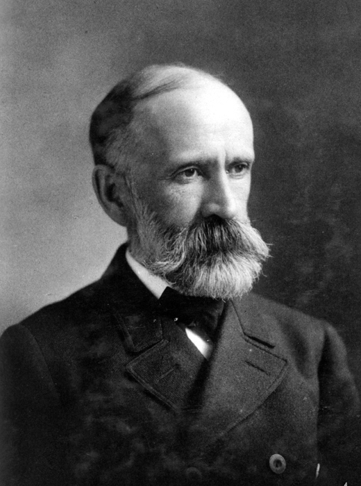
In the summer of 1890, a small team of scientists ventured into one of the most remote and treacherous landscapes in North America: the glaciers and peaks surrounding Mount St. Elias, where Alaska's coastline crashes into the Pacific. Led by geologist Israel C. Russell, representing the newly formed U.S. Geological Survey and National Geographic Society, the expedition had a dual mandate, establishing a portion of Alaska's contested eastern boundary while conducting the first rigorous scientific survey of a region that had confounded cartographers and captivated adventurers for decades. What they found reshaped understanding of glacial formation, exposed a landscape of staggering beauty and danger, and captured a moment when America turned its gaze northward toward a territory still shrouded in mystery. Russell writes with the careful precision of a scientist and the wonder of a man witnessing the extraordinary. His account documents not only the technical achievements, careful measurements, boundary markers, geological samples, but also the visceral realities of Arctic exploration: weeks trapped by storms, near-death crossings of ice bridges, and the overwhelming silence of glaciers that had not been touched by human eyes for millennia. This is primary source history at its most vivid, a document from an age when exploration still meant genuine discovery, when maps held blank spaces, and when a journey to Alaska was an expedition into the unknown.
Editions
Link to this book
Add a free, dofollow link to Lex on your blog, forum, syllabus, or reading list.
<a href="https://lex-books.com/book/an-expedition-to-mount-st-elias-alaska-06471707-946f-4166-b4e9-ce331ecc8ffe"><img src="https://lex-books.com/badges/read-on-lex.svg" alt="Read An Expedition to Mount St. Elias, Alaska by Israel C. Russell free on Lex" width="160" height="40"></a>[](https://lex-books.com/book/an-expedition-to-mount-st-elias-alaska-06471707-946f-4166-b4e9-ce331ecc8ffe)[url=https://lex-books.com/book/an-expedition-to-mount-st-elias-alaska-06471707-946f-4166-b4e9-ce331ecc8ffe][img]https://lex-books.com/badges/read-on-lex.svg[/img][/url]Read An Expedition to Mount St. Elias, Alaska by Israel C. Russell free on Lex: https://lex-books.com/book/an-expedition-to-mount-st-elias-alaska-06471707-946f-4166-b4e9-ce331ecc8ffeCite this book
Reading this edition for a paper or guide? Copy a citation.
Russell, Israel C.. An Expedition to Mount St. Elias, Alaska. Lex, lex-books.com/book/an-expedition-to-mount-st-elias-alaska-06471707-946f-4166-b4e9-ce331ecc8ffe.Russell, I. C. (n.d.). An Expedition to Mount St. Elias, Alaska. Lex. https://lex-books.com/book/an-expedition-to-mount-st-elias-alaska-06471707-946f-4166-b4e9-ce331ecc8ffeRussell, Israel C.. An Expedition to Mount St. Elias, Alaska. Lex. https://lex-books.com/book/an-expedition-to-mount-st-elias-alaska-06471707-946f-4166-b4e9-ce331ecc8ffe.